structured Abstract landscapes inspired by aerial RECONNAISSANCE PHOTOGRAPHS taken during wwII
The D-day beaches of normandy as seen from above on june 5th 1944
-
![]()
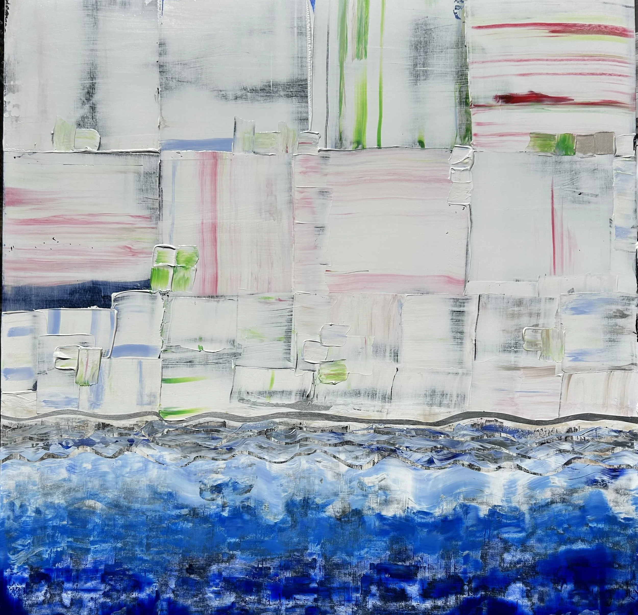
Juno Beach June 5th 1944
48” x 48” acrylic on gallery depth canvas
Juno beach spanned from Courseulles village just east of the British beach Gold, to Saint Aubin Sur Mer, and just west of the British beach Sword.
Taking Juno was the responsibility of the Canadian Army with sea transport, mine sweeping, and a naval bombardment force provided by the Royal Canadian Navy and the British Royal Navy as well as elements from the Free French, Norwegian and other Allied navies.
The objectives of the 3rd Canadian Infantry Division on D-Day were to cut the Caen-Bayeux road, seize the Carpiquet airport west of Caen, and form a link between the two British beaches on either flank.
The beach was defended by two battalions of the German 716th Infantry Division with elements of the 21st Panzer Division held in reserve near Caen. The invasion plan called for two brigades of the 3rd Canadian Division to land on two beach sectors—Mike and Nan—focusing on Courseulles, Berniers and Saint-Aubin.
It was hoped that the preliminary naval and air bombardments would soften up the beach defences and destroy coastal strong points. Close support on the beaches was to be provided by amphibious tanks of the 2nd Canadian Armoured Brigade and specialized armoured vehicles of the 79th Armoured Division of the United Kingdom.
Once the landing zones were secured, the plan called for the 9th Canadian Infantry Brigade to land reserve battalions and deploy inland, the Royal Marine commandos to establish contact with the British 3rd Infantry Division on Sword and the 7th Canadian Infantry Division to link up with the British 5th Infantry Division on Gold.
The 3rd Canadian Division’s D-Day objectives were to capture Carpiquet Airfield and reach the Caen– Bayeux railway line by nightfall.
-
![]()
Omaha Beach Charlie Section June 5th 1944
48” x 48” acrylic on gallery depth canvas
Omaha refers to an 8-kilometer (5 mile) section of the coast of Normandy France, facing the English Channel from east of Sainte Honorine-des-Pertes to west of Vierville-sur-Mer on the right bank of the Douve River estuary.
Landings here were necessary to link the British landings to the east at Gold with the American landing to the west at Utah thus providing a continuous lodgement on the Normandy coast of the Bay of The Seine.
Taking Omaha was to be the responsibility of the United States Army troops, with sea transport, mine sweeping, and a naval bombardment provided predominantly by the United States Navy and Coast Guard with contributions from the British, Canadian and Free French navies.
The primary objective at Omaha was to secure a beachhead eight kilometers (5 miles) deep, between Port-en-Bession and the Vire River, linking with the British landings at Gold to the east, and reaching the area of Isigny to the west to link up with VII Corps landing at Utah.
The untested American 29th Infantry Division along with nine companies of U.S. Army Rangers redirected from Point De Hoc, assaulted the western half of the beach. The battlehardened 1st Infantry Division was given the eastern half.
-
![]()
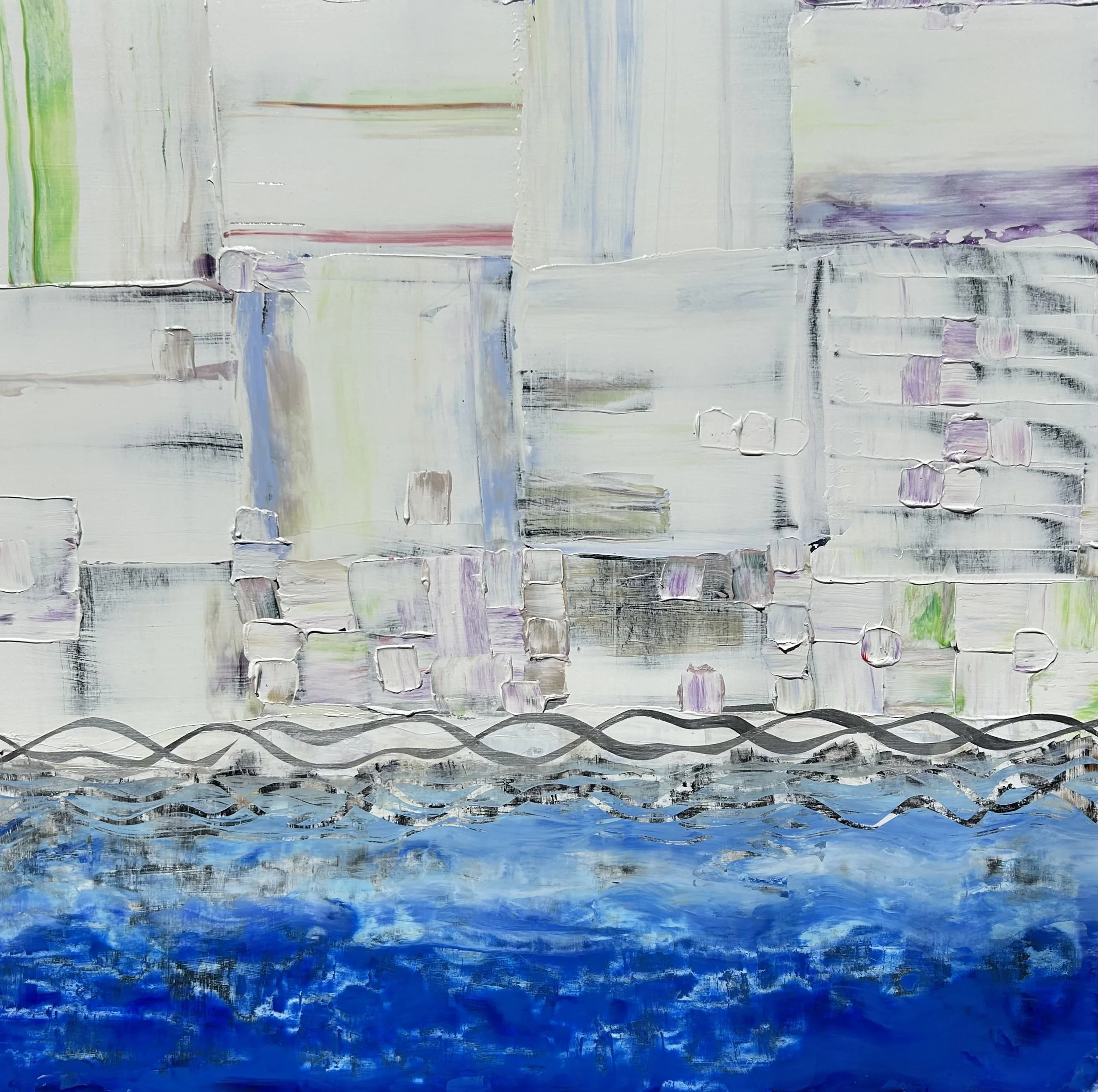
Utah Beach June 5th 1944
48” x 48” acrylic on gallery depth canvas
Point Du Hoc is a promontory with a 100-foot (30 m) cliff overlooking the English Channel on the northwestern coast of Normandy in the Calvados Department of France.
During World War II it was the highest point between the American sector landings at Utah Beach to the west and Omaha Beach to the east. The German army fortified the area with concrete casemates and gun pits. On D-Day, the United States Army Ranger Assault Group attacked and captured Pointe du Hoc after scaling the cliffs.
In the months before D-Day the Germans were recorded by Allied Intelligence removing their guns one by one as they re-developed the site with the final aim of establishing four casemates facing Utah Beach and the possibility of 2 x 155mm guns in open emplacement.
During the preparation for Operation Overlord it was determined by American Lt. Col. Rudder, that Pointe du Hoc should be attacked by ground forces, to prevent the Germans using the casemates.
Recently released documents in the US Archives show that Rudder knew prior to landing that the casemates were unfinished and only two were actually structurally close to being ready. They remain that way today. The U.S. 2nd and 5th Ranger Battalions were given the task of assaulting the strong point early on D-Day.
When the Rangers made it to the top at Pointe du Hoc, they had sustained 15 casualties. “Ranger casualties on the beach totaled about 15, most of them from the raking fire to their left.” The force also found that their radios were ineffective.
Upon reaching the fortifications, most of the Rangers learned for the first time that the main objective of the assault, the artillery battery, had been removed.
The Rangers regrouped at the top of the cliffs, and a small patrol went off in search of the guns. Two different patrols found five of the six guns nearby (the sixth was being fixed elsewhere) and destroyed their firing mechanisms with thermite grenades.
-
![]()
Sword Beach June 5th 1944
48” x 48” acrylic on gallery depth canvas
Sword, commonly known as Sword Beach, was the code name given to one of the five main landing areas along the Normandy coast during the initial assault phase known as Operation Neptune, part of Operation Overlord, the Allied invasion of German-occupied France that commenced on June 6, 1944.
Stretching 8 kilometres (5.0 mi) from Ouistreham to Saint Aubin Sur Mer, the beach proved to be the easternmost landing site of the invasion after the aborted attack on a sixth beach, code-named Band.
Taking Sword was to be the responsibility of the British Army with sea transport, mine sweeping, and a naval bombardment force provided by the British Royal Navy as well as elements from the Polish, Norwegian and other Allied navies.
Among the five beaches of the operation, Sword is the nearest to Caen being located around 15 kilometres (9.3 mi) from the goal of the 3rd Infantry Division. The initial landings were achieved with low casualties, but the advance from the beach was slowed by traffic congestion and resistance in heavily defended areas behind the beachhead.
Further progress towards Caen was halted by the only armoured counterattack of the day mounted by the 21st Panzer Division. The assault on Sword began at about 03:00 hrs with the aerial and naval bombardment of German coastal defences and artillery sites.
The landing was to be concentrated on Queen Red and Queen White in front of Hermanville Sur Mer, other approaches having proven impassable due to shoals. At 07:25 hrs, the first units set off for the beach.
These were the amphibious DD tanks of the 13th/18th Hussars; they were followed closely by the 8th Infantry Brigade, and by Royal Engineers in AVRE’s and the various odd-looking, specialized vehicles that had been nicknamed “Hobarts Funnies” The engineers set to work clearing mines and obstacles under a steady hail of small arms fire and artillery fire from Périers Ridge just south of Hermanville.
Resistance on the beach was initially fairly strong, with wrecked vehicles piling up and casualties mounting; however, when most of their armoured vehicles successfully landed, the British were able to quickly secure the immediate area.
By 09:30 hrs the engineers had cleared seven of the eight exits from the beach, allowing the inland advance to begin.
-
![]()
Gold Beach June 5th 1944
48” x 48” acrylic on gallery depth canvas
The units that first landed on Gold Beach belong to the 50th (Northumbrian) Infantry Division and Commando No. 47 of the Royal Navy. These two units belong to the 30th British Corps led by Lieutenant General GC Bucknall, one of the two assault corps of the 2nd Army commanded by General Miles Dempsey.
Gold beach, located between the towns of Port-en-Bessin and La Rivière, is divided into four main sectors: “How” in the extreme west, followed to the east of “Item,” “Jig,” and “King.” The assault mainly took place in the “Item,” “Jig,” and “King” sectors, between Asnelles-sur-Mer and La Rivière, in order to keep the town of Arromanches intact.
This strategy proved to be useful during the creation and the use of a future artificial harbor that the Allies would install once the bridgehead was secured.
Gold Beach was defended by the men of the 716th German infantry division, made up of 29 companies and armed with 500 machine guns, 50 mortars and 90 guns of various calibres. Elements of the 352nd Infantry Division were also positioned west of Gold Beach.
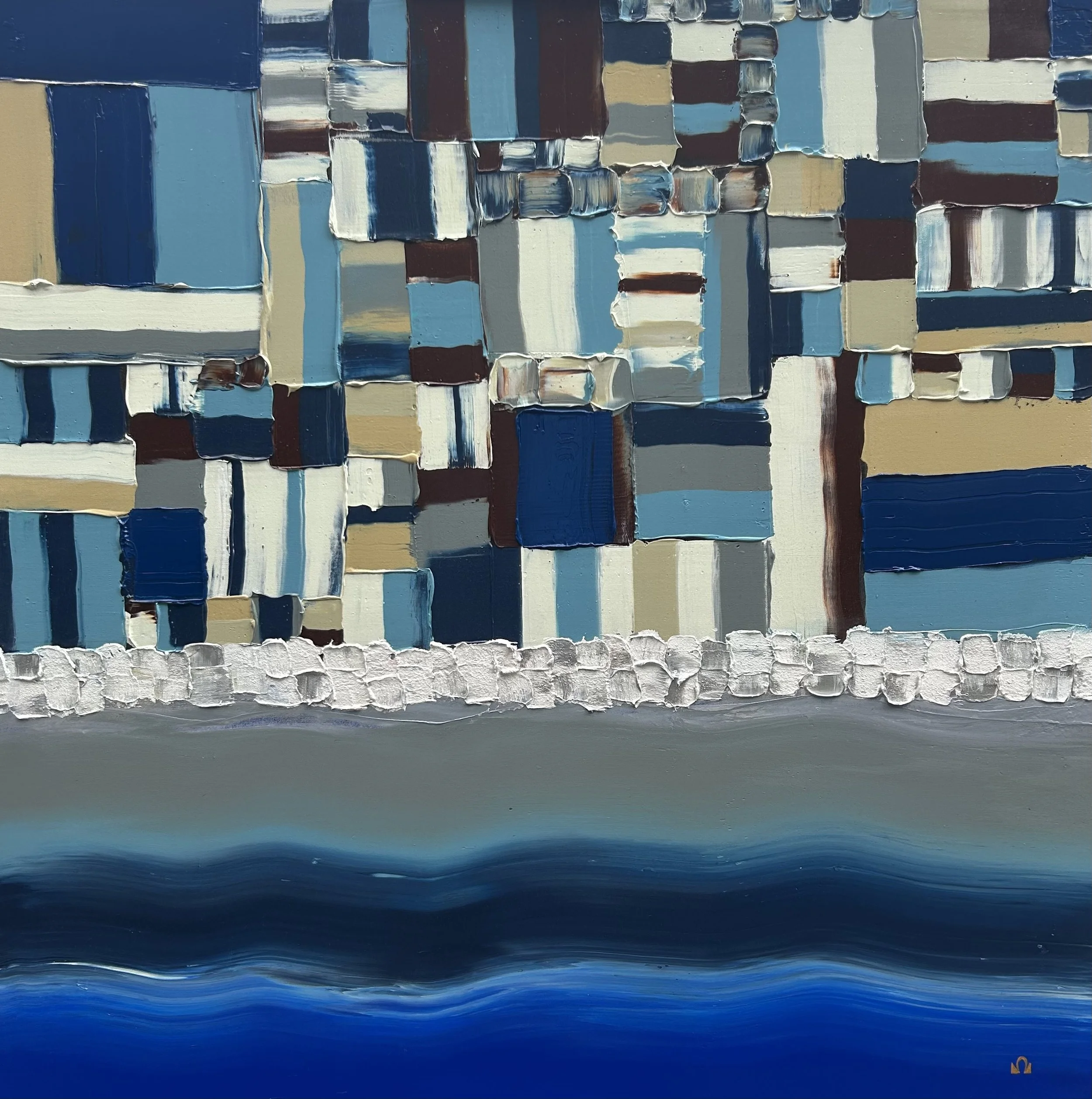


Juno Beach and Sugar Beach in sicily as seen from above
-
![]()
Juno Beach Winter I
48” x 48” acrylic on gallery depth board with a white frame
Juno beach spanned from Courseulles village just east of the British beach Gold, to Saint Aubin Sur Mer, and just west of the British beach Sword.
Taking Juno was the responsibility of the Canadian Army with sea transport, mine sweeping, and a naval bombardment force provided by the Royal Canadian Navy and the British Royal Navy as well as elements from the Free French, Norwegian and other Allied navies.
The objectives of the 3rd Canadian Infantry Division on D-Day were to cut the Caen-Bayeux road, seize the Carpiquet airport west of Caen, and form a link between the two British beaches on either flank.
The beach was defended by two battalions of the German 716th Infantry Division with elements of the 21st Panzer Division held in reserve near Caen. The invasion plan called for two brigades of the 3rd Canadian Division to land on two beach sectors—Mike and Nan—focusing on Courseulles, Berniers and Saint-Aubin.
It was hoped that the preliminary naval and air bombardments would soften up the beach defences and destroy coastal strong points. Close support on the beaches was to be provided by amphibious tanks of the 2nd Canadian Armoured Brigade and specialized armoured vehicles of the 79th Armoured Division of the United Kingdom.
Once the landing zones were secured, the plan called for the 9th Canadian Infantry Brigade to land reserve battalions and deploy inland, the Royal Marine commandos to establish contact with the British 3rd Infantry Division on Sword and the 7th Canadian Infantry Division to link up with the British 5th Infantry Division on Gold.
The 3rd Canadian Division’s D-Day objectives were to capture Carpiquet Airfield and reach the Caen– Bayeux railway line by nightfall.
-
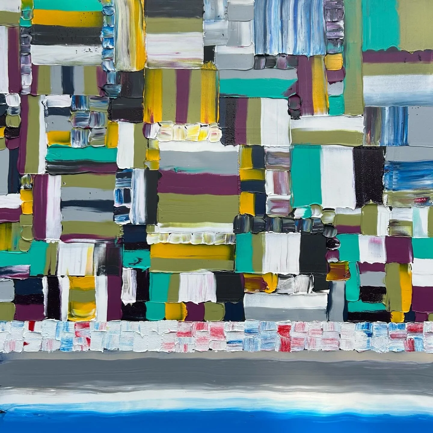
![]()
June Beach Winter II
48” x 48” acrylic on gallery depth board with a white frame
Juno beach spanned from Courseulles village just east of the British beach Gold, to Saint Aubin Sur Mer, and just west of the British beach Sword.
Taking Juno was the responsibility of the Canadian Army with sea transport, mine sweeping, and a naval bombardment force provided by the Royal Canadian Navy and the British Royal Navy as well as elements from the Free French, Norwegian and other Allied navies.
The objectives of the 3rd Canadian Infantry Division on D-Day were to cut the Caen-Bayeux road, seize the Carpiquet airport west of Caen, and form a link between the two British beaches on either flank.
The beach was defended by two battalions of the German 716th Infantry Division with elements of the 21st Panzer Division held in reserve near Caen. The invasion plan called for two brigades of the 3rd Canadian Division to land on two beach sectors—Mike and Nan—focusing on Courseulles, Berniers and Saint-Aubin.
It was hoped that the preliminary naval and air bombardments would soften up the beach defences and destroy coastal strong points. Close support on the beaches was to be provided by amphibious tanks of the 2nd Canadian Armoured Brigade and specialized armoured vehicles of the 79th Armoured Division of the United Kingdom.
Once the landing zones were secured, the plan called for the 9th Canadian Infantry Brigade to land reserve battalions and deploy inland, the Royal Marine commandos to establish contact with the British 3rd Infantry Division on Sword and the 7th Canadian Infantry Division to link up with the British 5th Infantry Division on Gold.
The 3rd Canadian Division’s D-Day objectives were to capture Carpiquet Airfield and reach the Caen– Bayeux railway line by nightfall.
-
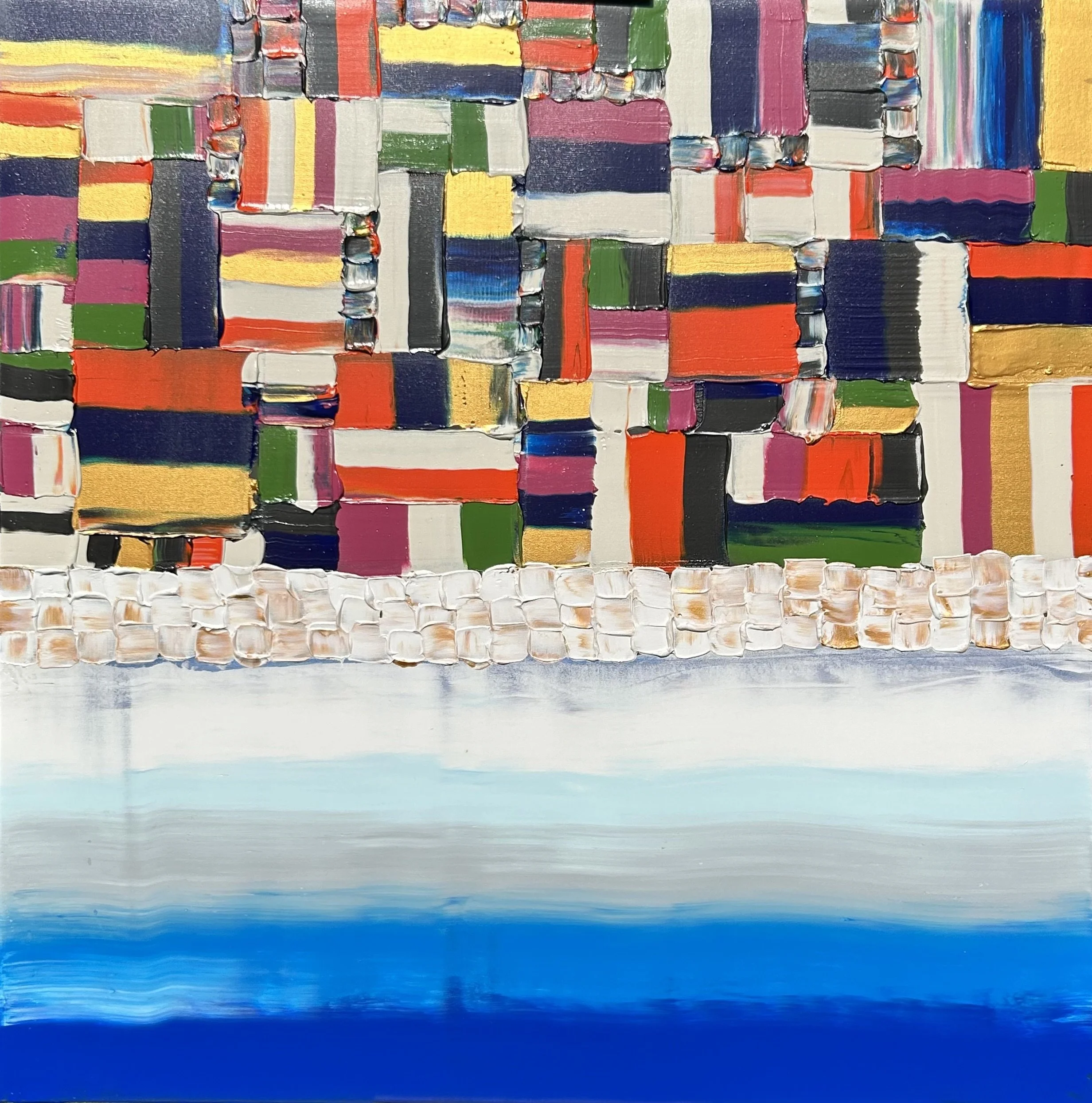
![]()
SOLD Spagia "Sugar" Beach II
48” x 48” acrylic on gallery depth board with a white frame
This painting is my tribute to the 48th Highland Regiment of Canada who landed on Spagia "Sugar" Beach in Sicily in the early hours of July 10th 1943.
This action was the first step in the Canadian effort to help liberate Europe from the grips of fascism.
The beach is part of the Amber Coast (Costa dell’ Ambra in Italian) extends from a point two miles west of the extreme end of the Pachino peninsula, running five miles to the north-west in an arc, bounded by two headlands, the Cape of Ants (Punta delle Formiche) in the south and Castle Point (Punta Castellazzo) in the north.
The long beach is divided in two naturally by “the Caves” (le Grotticelle), a small outcropping of limestone. It was this stretch of sand that became BARK WEST, the left half code named SUGAR and the right ROGER.
The beach itself offered no real obstacle; behind lay a limestone ridge with a maximum rise of 10 feet, with gently sloping ground behind covered in sand and patches of poor soil.
Behind SUGAR lay marshy terrain, including the Pantano Longarini, a large slough impassable to motor vehicles. Farmer’s fields were bounded by “dry stone” walls, and a rough cart track connected the provincial road running Pachino-Ispica to a point a mile inland from Grotticelle. Pachino’s airfield sat at the junction of these roads – the only such airstrip on the peninsula – and the town lay a mile further east, home to 22,000 people, some three miles beyond ROGER.
The real obstacles lay to sea, where false beaches were discovered offshore, meaning infantry disembarking from landing craft might find themselves marooned on sandbars, on the wrong side of lagoons too deep to wade through to get to the island itself.
One such sand bar was found off ROGER by a submarine patrol, over 600 yards long, 18 inches under the water, and with a nine-foot drop-off on the landward side. A shallower sandbar at SUGAR still had a five-foot drop. To meet this contingency, the Canadians put three assault companies into LCT landing craft carrying DUKW amphibious trucks.
Toronto’s 48th Highlanders Regiment eventually made it’s way to Holland and was the first to march into the Dutch capital of Appledorn on May 6th 1944 -liberating the city from the tyranny of Nazi rule.
Experiments in blue - chasing u Boats in the english channel
-
![]()
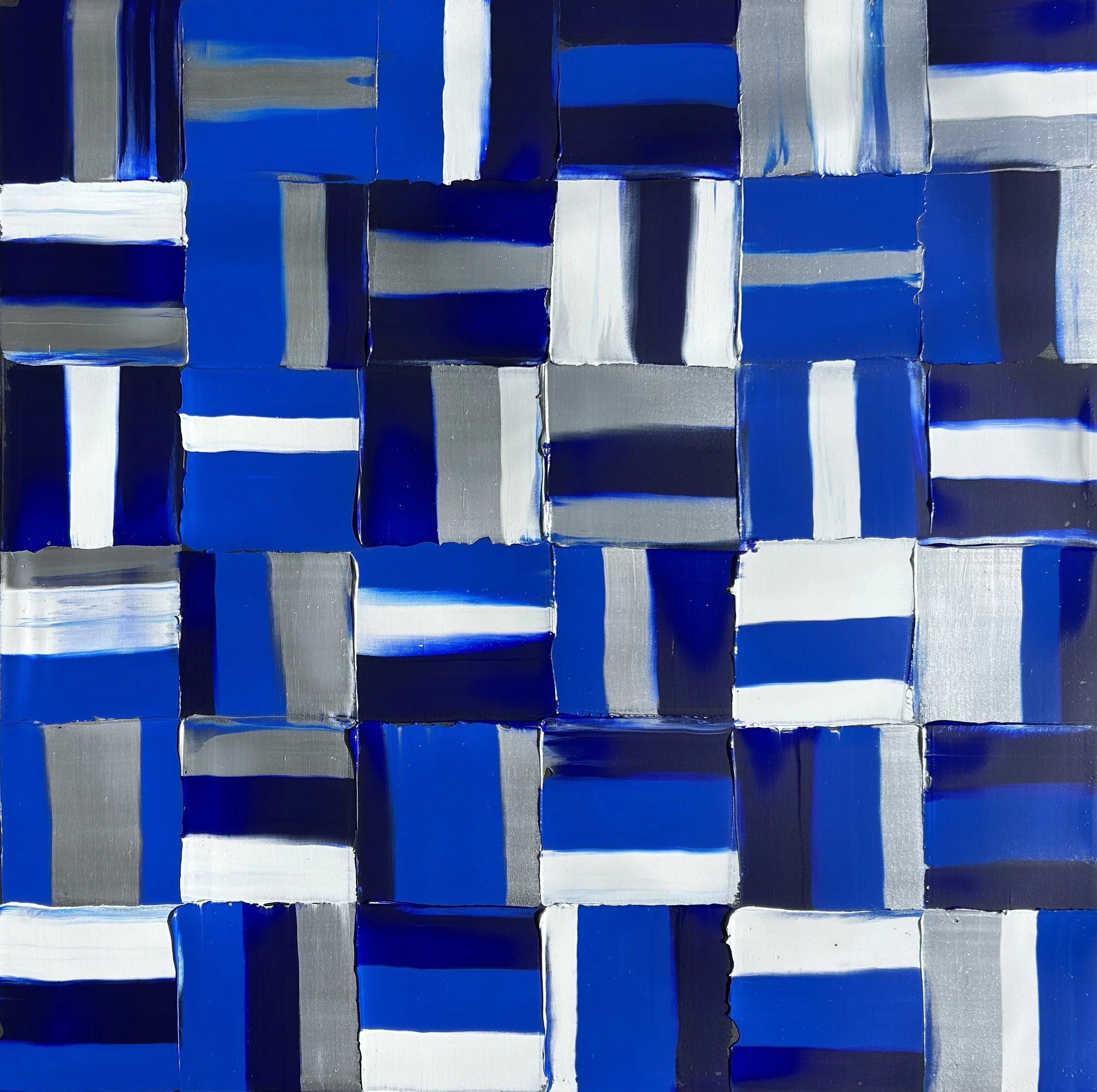
Experiments in Blue Effort Number XI
48” x 48” acrylic on gallery depth canvas
Following the fall of France in 1940, German submarine forces started operating from bases along the Biscayan coast.
As the war intensified, upward of 100 U-boats sailed to and from massive concrete-roofed pens at Brest, Lorient, Saint-Nazaire, La Pallice, and Bordeaux every month. These undersea predators proved extraordinarily difficult to defeat and by 1941 were sinking a large percentage of the war matériel, fuel, and food that Great Britain needed to stay in the war.
Something had to be done about Germany’s U-boats, and soon. Air Chief Marshal Sir Philip Joubert, in charge of the Royal Air Force (RAF) Coastal Command, put his Operational Research Section (ORS) to work on the problem.
The ORS consisted of British scientists and mathematicians charged with advising operational commanders on technological solutions. Already, ORS’s out-of-the-box thinkers could claim credit for developing a reliable magnetic detonator fitted to aerial depth charges and a more effective camouflage pattern for low-flying patrol aircraft.
Their work on increasing the lethality of air-delivered antisubmarine munitions through improved explosive filler and shallower detonation settings had, by the middle of 1941, begun to pay dividends in angry
-
![]()
Experiments in Blue Effort Number XXI
24” x 20” oil on canvas
-
![]()
If it ain't Dutch it Ain't Much
36” x 24” oil on gallery depth canvas


roundels - the brightly coloured symbols on commonwealth country aircraft
-
![]()
RAF Roundel with Silver Maple and Rivets
48” x 48” acrylic on gallery depth board with stainless steel rivets featuring a proud Canadian Silver Maple..
This painting is an example of the roundels of early WWII and includes a Canadian Silver Maple that our crews applied to their planes to indicate they were Canadians.
The Type A roundel is the series of rings that you see in red, white and blue in the painting. This is the same roundel or cockade that has come down through history, with variations, since the First World War.
It can be found on the RAF home page today with minor changes to the proportions first delineated long before the Second World War, or even the formation of the RAF.
Today, the RAF roundel is called the Type D. The modern Type D roundel has a diameter ratio of 1:2:3 for the red, white and blue circles, whereas the Second World War Type A roundel of the RAF, RCAF, RAAF and RNZAF, as seen above, had a ratio of 1:3:5.
During and since the First World War, the ratio of red and blue to white almost seems to be up to the manufacturer, unit or even the painter, but all were at least trying to adhere to standards.
-
![]()
RAF Roundel
36” diameter acrylic on 2” board
The original Royal Flying Corps (RFC) roundel of the First World War was derived from a traditional martial decorative device known as the “cockade.”
The cockade is a knot of ribbon, or other circular- or oval-shaped symbol of distinctive national colours which was usually worn on a soldier’s clothing, particularly on head gear. In the 18th and 19th Centuries, various European states used cockades to denote the nationalities of their military. Even Union and Confederate soldiers of the Civil War often wore cockades or “rosettes” on their dress uniforms and for formal photographs.
Along with NCO chevrons, brass buttons, ribbons, awards and epaulettes, the cockade was an item of military dress and distinction. More importantly, its colours were often those of the country it represented. When the First World War started in 1914, it was the habit of ground troops to fire on all aircraft, friend or foe, which “encouraged” the need for some form of identification mark on all aircraft.
At first, the Union Flag was painted under the wings and on the sides of the fuselages of RFC aircraft. It soon became obvious that, at a distance, the St George’s Cross of the Union Flag could be confused with the Iron Cross that was already being used to identify German aircraft — particularly from below and against the glare of the sky. After a Union Flag inside a shield was tried unsuccessfully, it was decided to follow the lead of the French air force which used a circular symbol resembling a “cockade” (a rosette of red and white with a blue centre).
The British reversed the colours and it became the standard marking on Royal Flying Corps aircraft from December 11, 1914, although it was well into 1915 before the new marking was used entirely consistently. The Royal Naval Air Service meanwhile briefly used a red ring, without the blue centre, until it was sensibly decided to standardize RFC roundels for all British aircraftion goes here
-
![]()
RAF Roundel with Victory Markings
48” x 60” acrylic on canvas
The Spitfire was a British single-seat fighter aircraft that was used by the Royal Air Force and other Allied countries before, during, and after World War II.
Many variants of the Spitfire were built, using several wing configurations, it was produced in greater numbers than any other British aircraft. It was also the only British fighter produced continuously throughout the war. The Spitfire was designed as a short-range, high-performance interceptor aircraft by R. J. Mitchell, chief designer at Supermarine Aviation Works, which operated as a subsidiary of Vickers-Armstrong starting in 1928. Mitchell created the Spitfire’s distinctive elliptical wing with cutting-edge sunken rivets (designed by Beverley Shenstone) to have the thinnest possible cross-section, helping give the aircraft a higher top speed than several contemporary fighters, including the Hawker Hurricane.
A victory marking (also called a victory mark, kill marking, or kill mark) is a symbol applied in stencil or decal to the side of a military aircraft to denote an aerial victory achieved by the aircraft’s pilot or crew. The use of victory markings originated during World War I, burgeoned during World War II and frequently took the form of the roundel or national flag of the nationality of the aircraft defeated.
This was my first large scale painting completed in honour of Richard Alexander Howley the only Canadian born pilot to fly in the Battle of Britain. He was born on April 16, 1920, in Victoria, British Columbia, where his Dad, on loan from the Royal Navy, was stationed at the naval base.
He received his education at St. Boniface College in Saint John’s, Newfoundland, and at Colebrook in the United Kingdom. He was killed in action and his body was never recovered from the English Channel. Painted in September 2020 on the 80th anniversary of the Battle of Britain.


quirky military portraits
-
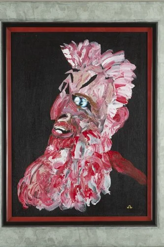
![]()
21 12
12” x 16” with custom frame
Erik Thorvaldsson (c. 950 – 1003) Known as Erik the Red, he was a Norse explorer, described in medieval and Icelandic saga sources as having founded the first settlement in Greenland.
He most likely earned the epithet “The Red” due to the color of his hair and beard. According to Icelandic sagas, he was born in the Jæren district of Rogaland, Norway, as the son of Thorvald Asvaldsson.
Erik’s own son was the well-known Icelandic explorer Leif Erikson who became the first Viking to explore the land of Vinland–part of North America, probably near modern-day Newfoundland. Leif invited his father on the voyage, however, according to legend, Erik fell off his horse on the way to the ship and took this as a bad sign, leaving his son to continue without him.
Erik died in an epidemic that killed many of the Greenland colonists in the winter after his son’s departure.
Leif Erikson may be related to Alex Lifeson from Rush. Maybe. Sounds plausible..
-
![]()
polish revenge
12” x 16” with custom frame
General Stanislaw Maczek Polish Tank Commander 1st Armoured Division During the battle of the Falaise pocket August 21, 1944.
The final day of the victorious battle over the German Army that had invaded Poland in 1939.
-
![]()
Da Swede
12” x 16” with custom frame
Private Arvid Samuelson 3rd Company of the Armored Recon Battalion of the 11th SS Volunteer Armored Infantry Division Nordland.
This unit was composed of a large number of Swedes. Before Germany invaded the Soviet Union, very few if any Swedes served with the Germans, although at least one Swedish volunteer was listed as serving with the 5.SS-Panzer-Division Wiking.
When Germany invaded the Soviet Union, Swedish volunteers for the German Wehrmacht were gathered either through the German Legation in Stockholm or through the Auslands Organization, both via Norway. Swedish approval of recruitment was still not official until well after the invasion of the Soviet Union with just a few young men joining the SS. It is estimated that only 200 Swedes joined the Germans primarily to fight Communism.
Most of them attended the same college in Stockholm.
The peace sign I put on the helmet is to replace the SS symbol, ironically, the peace symbol was criticized as being too close to a Nazi symbol when it first appeared in the 1950’s as part of the British AntiNuclear movement.
The flower on his jacket is Sweden’s national flower the Linnea Borealis.